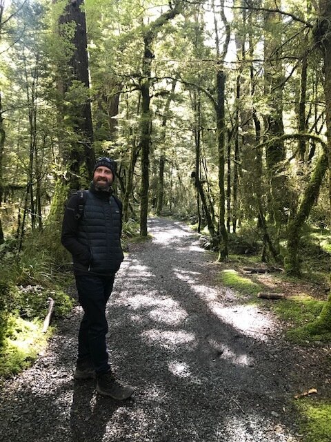
a big sigh, the Road to Milford Sound
The brilliant greens of the Lake Gunn nature walk on the Milford Sound road.
They say the journey is sometimes as good as the destination. And on occasions it can actually be better.
The whole aim of this blog is to encourage everyone to get out there are try things and sometimes that involves a long drive, sometimes it’s just down the road.
Milford Road is one of those journeys that transcends your everyday – it is something unforgettable and is worthy of the drive even if there was nothing worthwhile to see at the end. The end of this road though is Milford Sound – reckoned by many to be possibly the eighth wonder of the world. (please see my earlier blog about Milford Sounds boat cruises).

Taking a boat cruise at Milford Sound is a must do…
Milford Road leaves the township of Te Anau behind and follows the side of it’s namesakes lake for quite some time. Rolling hillside and lakeside accommodation passes by. In the distance large mountains loom their lofty peaks covered in snow. On the left hand side you pass the docking point for the boat ferrying hikers to the start of the legendary Milford Track, and then the road suddenly turns left and those mountains lie ahead of you. The farmland continues with fields full of hardy sheep, paradise shell ducks and some resilient cattle. This continues until you reach Etherington Valley, a long road takes you through the its heart alongside a braided river which roars through the valley.

Ethrington Valley on the road to MIlford
There are viewing points along the road to take photographs of the oncoming wilderness. A short drive further down the road reaches knobs flat, an accommodation and information point with an essential bathroom stop if one is needed. You then venture onwards until the landscape turns to bush and several Department of Conservation campsites hidden a short distance away. The next stopping point is on the left hand side with long pull off for Mirror Lakes.

A South Island Robin is a reluctant poser for photographs at Mirror Lakes, Milford Road
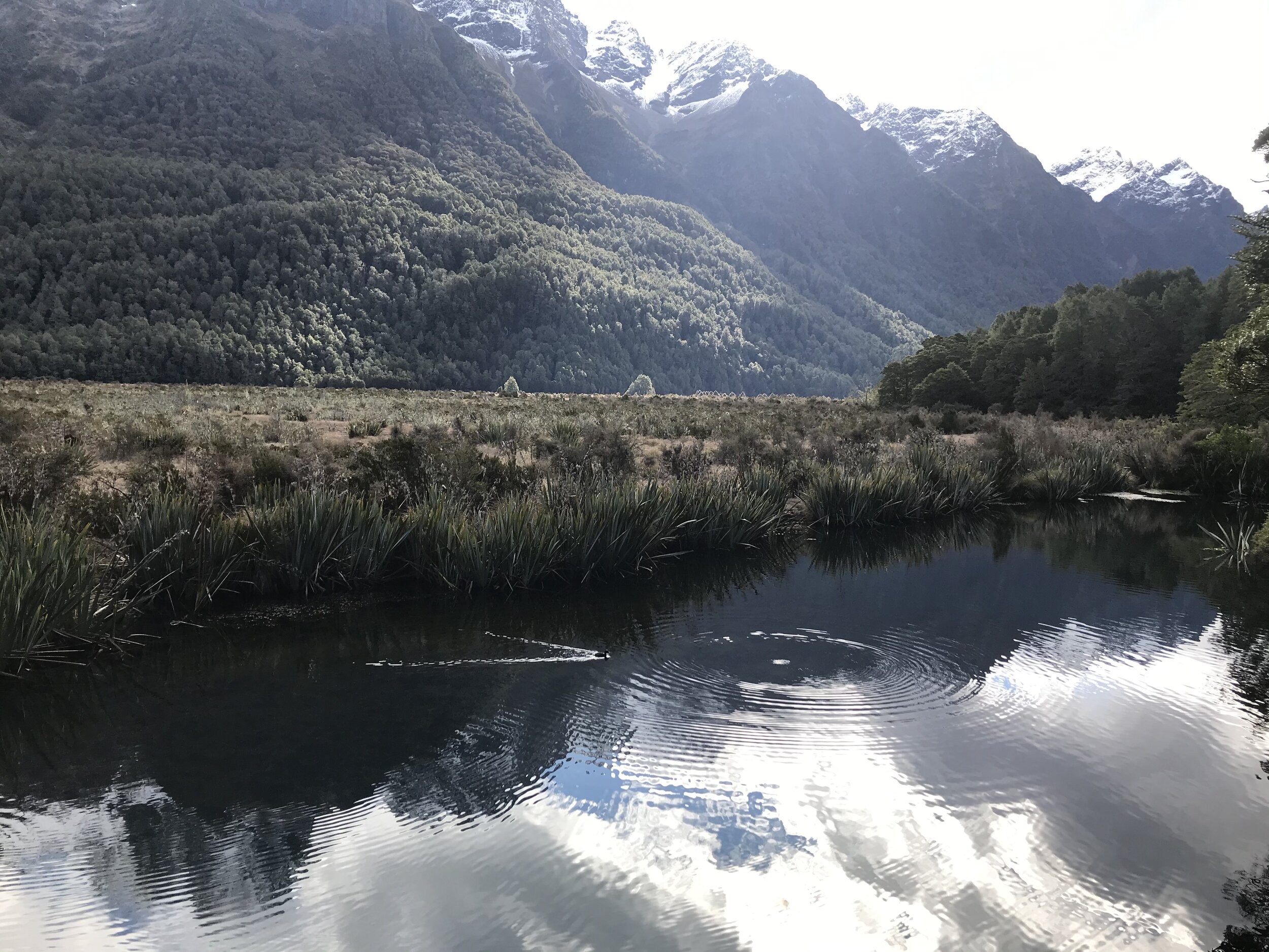
A boardwalk takes you above these small lakes to allow you a good vantage point to see the reflection in the water of the towering mountains looming above. They have even kindly left a sign above the lake reflecting the name of the place, very clever. On my visit I was alone for much of the time and that ensured lots of wildlife viewing – a grey duck, native to New Zealand was nearby pecking at insects floating on the water. I also spied a rare South Island Robin, which pirouetted a few times around me but didn’t seem to keen to pose for it’s photograph for some bizarre reason….

A rare ‘grey duck’ samples some insect life on the Mirror Lake surface. The reflection from the mountains above is also clear
As I drove onwards the bush became thicker and darker, creeping up alongside the roadway as if trying to reclaim it as its own. After a small one lane bridge a sign pointed towards a campsite and a nature walk. Intrigued I drove a short distance and parked up. An information board advised me that there was a 45 minute loop walk to enjoy down to the shore line of Lake Gunn.
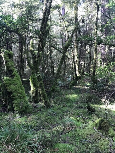
The green moss floor that greets you in the Milford Road bush
What struck me first was how green everything was. It was a shade of emerald bright and dazzling in the sunlight but dark and unnerving in the gloom. Everything was smothered in a moss of some sort. Trees grew out of other trees and hardy ferns covered the forest floor.
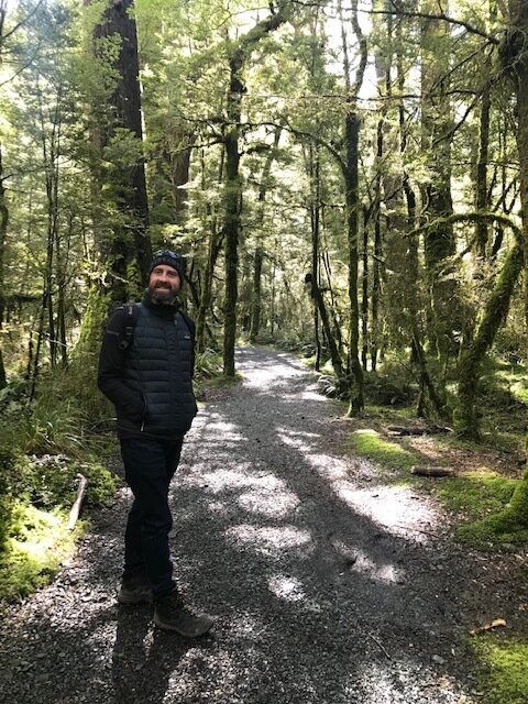
Dan at the start of the Nature Walk through native forest to the shoreline of Lake Gunn
An opening in the bush bought me to Lake Gunn, a lake surrounded on all sides by dense native bush. The water lapped at the small stones at my feet as I stood and admired the view. There wasn’t a sound to be heard except the lapping of the shallow clear water. I learnt that the lake stretched over 3km’s and I was only looking out at a small part of it. I continued on the loop walk back to my car listening to the local bird song echoing from the branches up above.

Trees growing up and around and out of other trees are common sights in this damp forest
The road as I drove onwards was now becoming narrower and windier. I passed a sign informing me that it was the last campsite available to Milford Sound, I was entering the true wilderness area.
I started climbing upwards noticing how the bush appeared to be getting thicker in places. The road now seemed to be cut out of the cliffside with a steep slope to the side of me along which waterfalls plummeted down. At least that’s what I think they did, as at this point my knuckles were white from the grip on my steering wheel.
Mountains surround you on all sides on Milford Road
On the way up to Milford the cloud was low and a fog had settled across the valley obscuring the views. On my way back however the sun had burnt it all away exposing the vast valley below. The pull off at the viewing point overlooking Hollyford Valley is named pops point after one of the original caretakers who sadly got swept away in an avalanche whilst trying to clear the road.
Coming next, the giant boulders, unfathomable terrain and Homer Tunnel
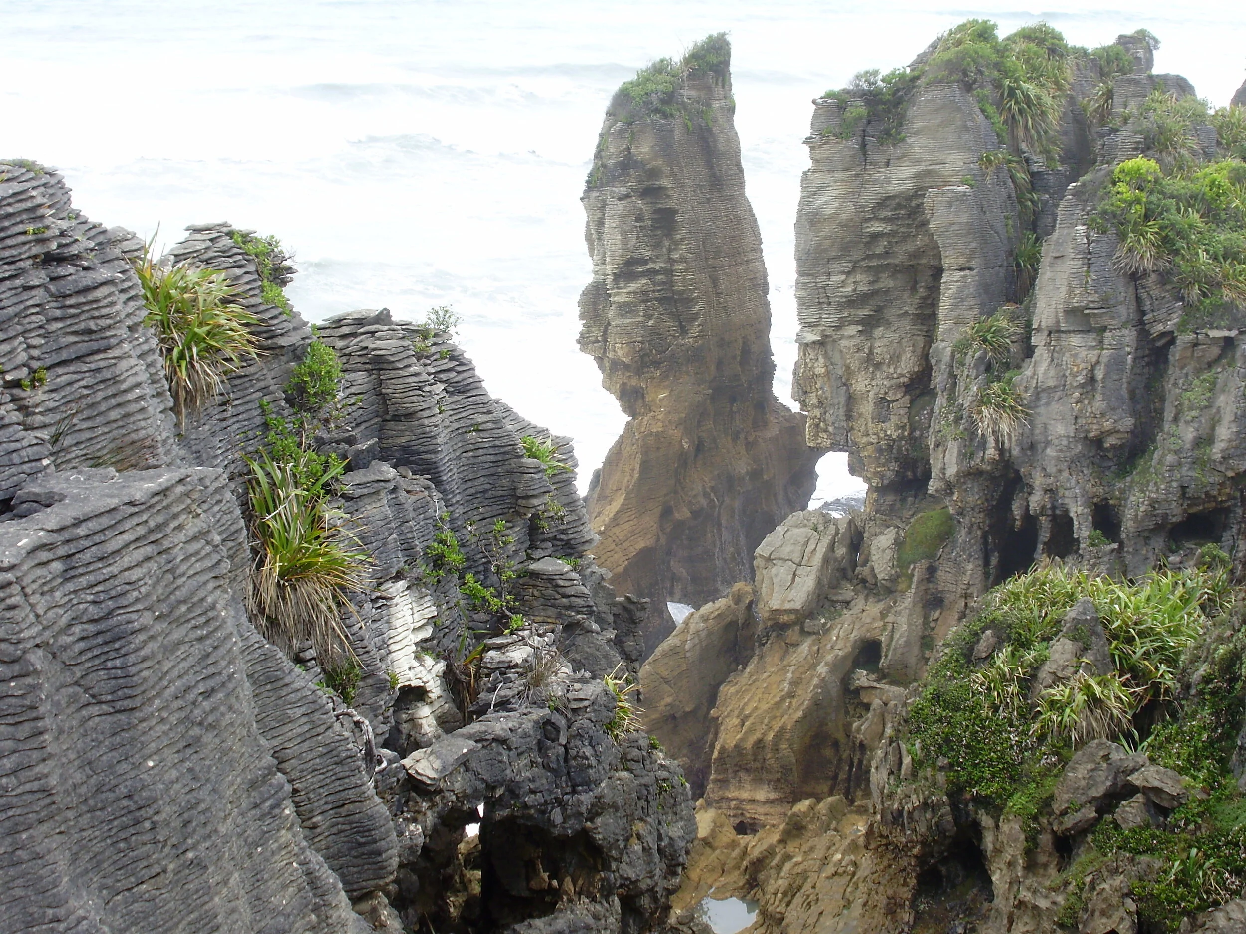
West Coast Pancakes
The West Coast does literally rock…..
After a day spent around the Hokitika area exploring the breath-taking colours of the gorge, the supreme serenity of Lake Kaniere and the tasty pizza concoctions of Fat Pippi (yes some of the best pizzas to be found anywhere are in Hokitika) it’s good to drive further up the West Coastline. The only road weaves along beside the rugged coastline squeezed between the mountains, rainforest and sea. The Tasman Ocean pounds the beaches on one side whilst the mountains of the Southern Alps rise majestically on the other. The main township north of Hokitika is Greymouth which offers numerous accommodation and refreshment options. It’s home to Speights Brewery, a world-famous beer often known as West Coast gold. The brewery offers tours and is reported to have one of the best restaurants in town. I haven’t tried it yet, but it is on my list. Greymouth is also the end of the line for the ‘Tranzalpine’, the scenic train journey that traverses from Christchurch on the East Coast through the mountainous Arthur’s Pass area.
North of Greymouth the road twists and turns around many corners and the scenery becomes largely dense bush and rainforest. There is a scattering of small settlements here and there and some wonderful places to stay offering incredible views. The rainforest ends where the rock-strewn coastline starts and there are endless sandy beaches to pull over and enjoy. Overall the atmosphere is one of isolation yet wonderment. A turn in the road can lead to yet another awe-inspiring vesta. The temptation in such a setting is to continue driving – and this is indeed an excellent option to consider as further up the coast are such wonders as Cape Foulwind and Karamea – both of which I will come to in a later blog, but the drive for today is to Punakaiki.
Punakaiki is popular with everybody due to its remarkable location with famous blowholes and pancake rocks. It’s so popular that sometimes its difficult to find a parking space close by.
Top Tip: if you have time stay the night in Punakaiki, there is some top accommodation options and excellent walks and kayaking trips to appreciate. You will also get to enjoy the pancake rocks at quieter times.The loop walkway is easy to manage, it traverses through a native bush area full of Nikau Palms that forms the start of the track and you soon understand why it’s called Pancake Rocks. The limestone cliffs have been battered by both the weather and the tide over the years so that they now resemble pancakes stacked jaggedly on top of one another. Try to time your walk with high tide and ideally a rough sea. This will enable you to witness the blowholes in their full glory – the one labelled ‘chimney’ is aptly named as when a powerful surge of water flows through the chamber underneath it forces itself up through the rock creating a spray of water that looks like steam rising upwards into the air. I’ve been lucky enough to visit the rocks in various sea conditions – with rough seas you are avidly watching the waves form out to sea keen for them to break in time to raise the water level to pound through the narrow chambers. But equally in calm seas the rocks can be just as appealing as looking outwards you can often spot Hector’s Dolphins (the world’s smallest) cruising by in small pods close to the coastline.
Once you have completed your circuit and taken all the required photographs head across the road that is opposite the walkway entrance Here you will find a Department of Conservation centre useful for souvenirs or ideas for further adventures along the West Coast. There are also a couple of cafes that offer some good refreshment.
My next blog in this series will take us further up this striking coastline to Cape Foulwind and Westport.

A journey to the West Coast - Arthurs Pass to Hokitika
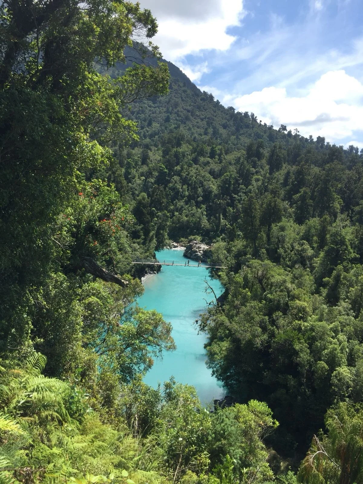
The vivid blue colours of Hokitika Gorge, well worth exploring on any road trip around the West Coast of the South Island
Arthurs Pass traverses its way through the mountain ranges of the Southern Alps in the middle of the South Island. Named after Arthur Dudley Dobson, who was the first European to escort a party through the area, it is a drive that requires you to have your camera at the ready. My first port of call was the small settlement of Sheffield. Sheffield is home to an amazing pie shop - one that is world famous around Canterbury! Each day they serve up a vast array of sweet and savoury pies and stopping for one is kind of a compulsion for anyone in the know. I bought my vegetarian pie (yes I know but I love my veggies, although the chicken pies are also pretty tasty) complete with a nanna slice (chocolate heaven) for afterwards and headed on my way. The scenery on this, the Eastern side of the Alps, is tussock grasses, oddly shaped rocks (Castle Rock is an excellent stopping point) glistening lakes brimming with trout, expansive braided rivers and sharp mountain edges. Numerous gravel tracks lead off the highway to various tramping tracks and ski resorts in winter. Everything is so immense it causes you to catch your breath.
Top Tip: stop at Arthurs Pass Village - it’s not only great for a refreshment break (the coffee is good), there is also a chance of spotting a Kea - the world’s only Alpine Parrot. I’ve had one approach me and try to pinch my mobile phone whilst I sat outside one of the roadside cafés sipping my coffee. Please don’t feed them though as so many die from being too close to the road or eating the wrong type of food.
As I left Arthurs Pass Village I noticed the scenery begin to change. The rainforest of the West Coast begins to emerge with enormous waterfalls plunging down from mountain edges and road sides covered in a dense assortments of ferns. This is the wet side of the country and the scenery certainly reflects that. Rugged forests climb high up the mountain edges. Arthurs Pass finishes at Kumara Junction where I joined State Highway 6 - the only road to be found up and down the West Coast. I was heading to Hokitika but first my journey took me through farmland towards Lake Kaniere. Even on a misty overcast day this lake is something else. It’s setting is sublime, with rainforest edging its shore and the peaks of the Southern Alps looming above. The lake is a mecca for watersport but I enjoyed wandering some of the tracks nearby. A loop walk took me through a Kahikatea forest and past a small stream. Weka (a native bird which looks a bit like a kiwi only it is active during the daytime and doesn’t have quite as long a beak) came and approached me as a I ate my pie at the lakeside.
I drove around the lakeside until the road zig zagged it’s way through farmland to Hokitika Gorge. Up ahead the weather had cleared and I could just about make out the peak of Aoraki/Mt Cook, New Zealand’s largest mountain. Hokitika Gorge is a real feature of this area - a place where the glacial rock salt has caused the water to look such a vivid blue it appears as though dye has been poured into it. I tried to take a picture from the viewing platform overlooking the gorge but couldn’t really do it justice. A pleasant board walk took me out to a swing bridge across the river - holding on to your bags and cameras here is a must as with a couple of people on it the bridge really does swing! On the other side the walk continued through untouched bush and I was serenaded by fantails and bellbirds. There is a spot where you can clamber down onto rocks and actually reach the rivers edge if you so wish.
That evening I headed back into Hokitika Town. Please see my next blog for the Hokitika and Pancake Rocks road trip weekend adventure.